BNOB plan maps
Among the more impressive maps on view recently were the following.
The first is a map that appeared in the Bring New Orleans Back Urban Planning Committee report (35 MB PowerPoint file) which really delivers a powerful message by showing the extent of flooding in New Orleans overlaid on a satellite image of Washington, D.C.: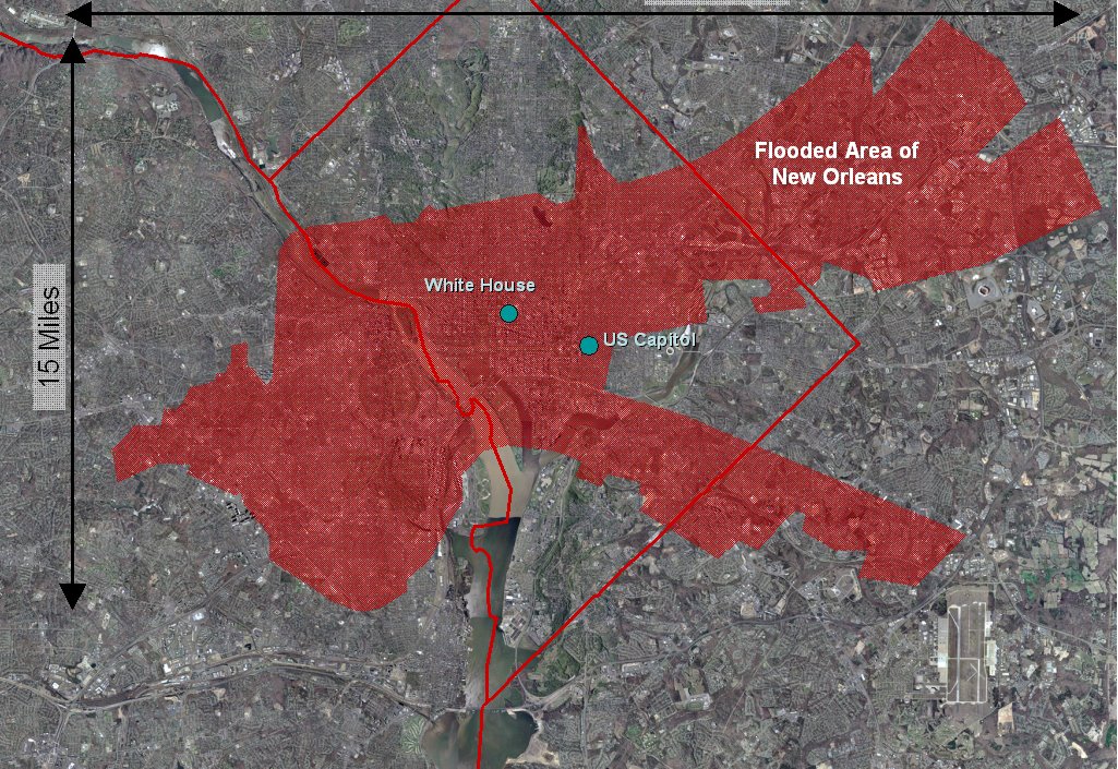
The other map of interest is a Times-Picayune composite of the different layers representing development areas in the BNOB Urban Planning Committee report:
1/16/06 update: Here's the download site for a compressed 6 MB version of the same BNOB PowerPoint presentation.
posted by Schroeder @ 5:12 PM
1 comments
![]()


1 Comments:
Good point - I have the flood maps, and Manhattan satellite imagery. I'll work on that.
Post a Comment
<< Home